News

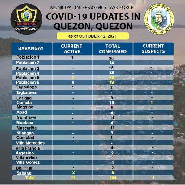
CoViD-19 Updates in Quezon, Quezon as of October 12, 2021
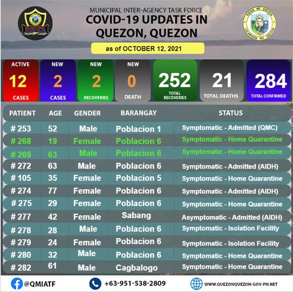
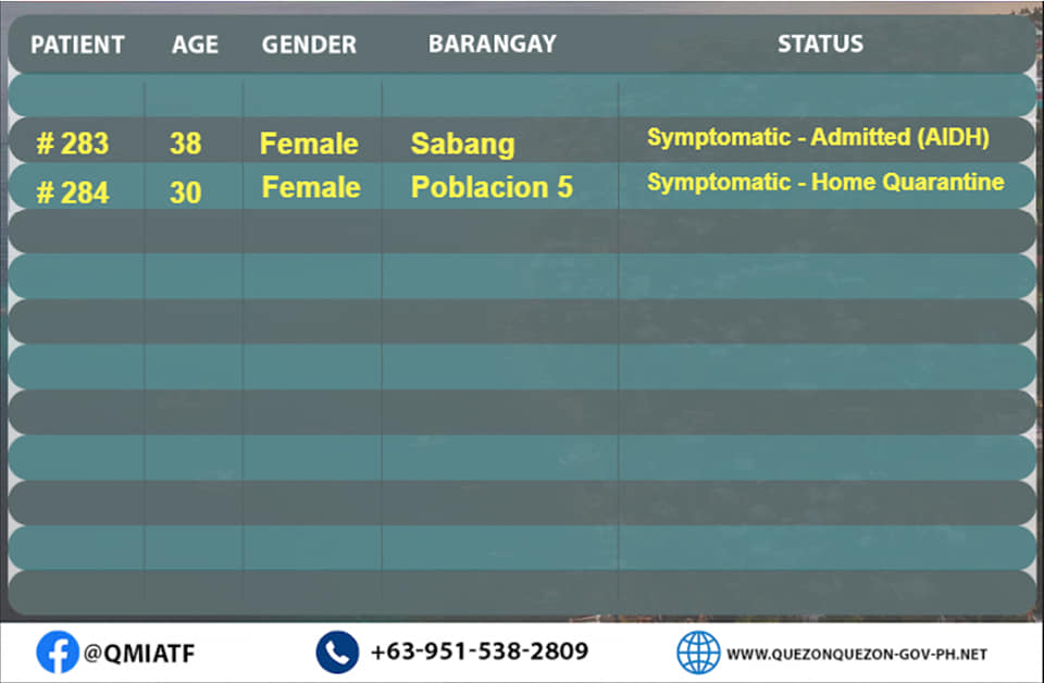
PABATID!!!
Makikita po sa mga sumusunod na ang ating Bayan ng Quezon, Quezon ay mayroong:
Dalawang bagong Recovered
Dalawang bagong nag Positibong kaso sa COVID-19 na mayroong sintomas.
Ngayon araw ay mayroon po tayong 12 kabuuang aktibong kaso ng COVID-19 dito sa Bayan ng Quezon, Quezon.
Ang ating IATF po ay nasa proseso ng karagdagang pagcocontact-tracing upang magabayan ang susunod na magiging hakbang.
Mahigpit pong pinapayuhan po ang lahat na mag-ingat at sumunod sa ating mga public health protocol.
Maraming salamat po.
THE LOW PRESSURE AREA EAST OF CAMARINES NORTE DEVELOPED INTO A TROPICAL DEPRESSION AND WAS NAMED “MARING”.
TROPICAL CYCLONE BULLETIN NO. 1
Tropical Depression “#MaringPH”
Issued at 5:00 PM, 07 October 2021
Valid for broadcast until the next bulletin at 11:00 PM today
THE LOW PRESSURE AREA EAST OF CAMARINES NORTE DEVELOPED INTO A TROPICAL DEPRESSION AND WAS NAMED “MARING”.
Location of Center (4:00 PM)The center of Tropical Depression “MARING” was estimated based on all available data at 505 km East of Virac, Catanduanes (13.3°N, 128.9°E) Intensity Maximum sustained winds of 45 km/h near the center, gustiness of up to 55 km/h, and central pressure of 1002 hPa Present Movement South southeastward at 15 km/h Extent of Tropical Cyclone Winds Strong winds or higher extend outwards up to 250 km from the center
TROPICAL CYCLONE WIND SIGNALS IN EFFECT
No Tropical Cyclone Wind Signal is currently in effect.
HAZARDS AFFECTING LAND AREAS
Heavy Rainfal
l• Today, the trough of “MARING” may bring light to moderate with at times heavy rains over Eastern Visayas.
• Under these conditions, scattered flooding (including flash floods) and rain-induced landslides are possible especially in areas that are highly or very highly susceptible to these hazard as identified in hazard maps
Severe Winds
Current track and intensity forecast shows that there is a moderate to high likelihood that Tropical Cyclone Wind Signals (TCWS) will be hoisted over several provinces in Northern Luzon by Saturday morning or afternoon. The highest possible wind signal for this tropical cyclone is TCWS #2. However, due to the uncertainty in the intensity forecast, there is a possibility that higher TCWS may be raised.
HAZARDS AFFECTING COASTAL WATERS
In the next 24 hours, moderate rough seas will prevail over the seaboards of Luzon and the eastern and western seaboards of Visayas and Mindanao. These conditions are risky for those using small seacrafts. Mariners are advised to take precautionary measures when venturing out to sea and, if possible, avoid navigating in these conditions. TRACK AND INTENSITY OUTLOOK
• Tropical Depression “MARING” developed from the Low Pressure Area over the Philippine Sea at 2:00 PM today.
• On the forecast track, the tropical depression will continue moving generally southeastward slowly in the next 12 hours before turning northward tomorrow afternoon. Afterwards, “MARING” will move north northwestward over the Philippine Sea by Saturday morning, gradually accelerating in the process. By Sunday afternoon, it will move west northwestward towards Extreme Northern Luzon and may pass close or make landfall over Babuyan Islands by Monday.
• “MARING” is forecast to remain tropical depression while moving over the Philippine Sea and may intensify into tropical storm by Sunday afternoon.
Considering these developments, the public and disaster risk reduction and management offices concerned are advised to take all necessary measures to protect life and property. Persons living in areas identified to be highly or very highly susceptible to these hazards are advised to follow evacuation and other instructions from local officials. For heavy rainfall warnings, thunderstorm/rainfall advisories, and other severe weather information specific to your area, please monitor products issued by your local PAGASA Regional Services Division.
The next tropical cyclone bulletin will be issued at 11:00 PM today.
DOST-PAGASA
Link: bit.ly/3eujmdC
TROPICAL CYCLONE BULLETIN NO. 1 Tropical Depression “#LanniePH” Issued at 5:00 AM, 04 October 2021
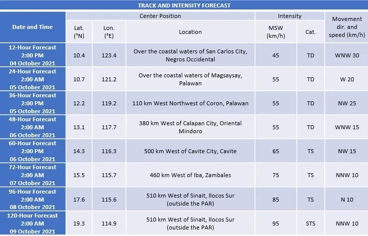
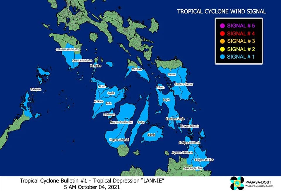
TROPICAL CYCLONE BULLETIN NO. 1Tropical Depression “#LanniePH”
Issued at 5:00 AM, 04 October 2021Valid for broadcast until the next bulletin at 8:00 AM today
THE LOW PRESSURE AREA EAST OF SURIGAO DEL NORTE DEVELOPED INTO A TROPICAL DEPRESSION AND WAS NAMED “LANNIE”
Location of Center (4:00 AM) The center of Tropical Depression “LANNIE” was estimated based on all available data at 100 km East of Surigao City, Surigao del Norte (9.8°N, 126.4°E) Intensity Maximum sustained winds of 45 km/h near the center, gustiness of up to 55 km/h, and central pressure of 1002 hPa Present Movement Northwestward at 20 km/h Extent of Tropical Cyclone Winds Strong winds or higher extend outwards up to200 km from the center
TROPICAL CYCLONE WIND SIGNALS IN EFFECTTCWS No. 1 (Strong winds prevailing or expected within 36 hours) Luzon
The southern portion of Masbate (Pio V. Corpuz, Cataingan, Palanas, Dimasalang, Uson, Mobo, Milagros, Mandaon, Esperanza, Placer, Cawayan, Balud), the southern portion of Romblon (Cajidiocan, San Fernando, Magdiwang, Santa Maria, Odiongan, Alcantara, Ferrol, Looc, Santa Fe, San Jose), the southern portion of Oriental Mindoro (Roxas, Mansalay, Bulalacao, Bongabong), the southern portion of Occidental Mindoro (Sablayan, Calintaan, Rizal, San Jose, Magsaysay), and the northern portion of Palawan (El Nido, Taytay, Dumaran, Araceli) including Calamian and Cuyo Islands. VisayasEastern Samar, Samar, Biliran, Leyte, Southern Leyte, Capiz, Aklan, Antique, Iloilo, Guimaras, Negros Occidental, the northern and central portions of Negros Oriental (Bais City, Mabinay, City of Bayawan, Basay, City of Tanjay, Manjuyod, Bindoy, Ayungon, Tayasan, Jimalalud, La Libertad, City of Guihulngan, Vallehermoso, Canlaon City), Cebu, and Bohol MindanaoSurigao del Norte, Dinagat Islands, the northern portion of Agusan del Norte (Magallanes, Remedios T. Romualdez, City of Cabadbaran, Tubay, Santiago, Jabonga, Kitcharao, Butuan City), the northern portion of Agusan del Sur (Sibagat, City of Bayugan, Prosperidad), and the northern portion of Surigao del Sur (San Miguel, Marihatag, San Agustin, Cagwait, Bayabas, Tago, City of Tandag, Cortes, Lanuza, Carmen, Madrid, Cantilan, Carrascal, Lianga)
HAZARDS AFFECTING LAND AREAS
Heavy Rainfall
• Today through tomorrow morning, moderate to heavy with at times intense rains are likely over Visayas, Bicol Region, MIMAROPA, CALABARZON, and Caraga Region. Light to moderate with at times heavy rains are also possible over Metro Manila, Bulacan, Bataan, and the rest of Mindanao.
• Under these conditions, scattered flooding (including flash floods) and rain-induced landslides are possible especially in areas that are highly or very highly susceptible to these hazard as identified in hazard mapsSevere Winds
• Strong winds (i.e., strong breeze to near gale conditions) with occasional gusts will be experienced within any of the areas where Tropical Cyclone Wind Signal #1 is in effect during the passage of the tropical depression. This may generally cause up to very light damage to structures and vegetation.
• An enhanced easterly flow north of the tropical depression may also bring occasionally gusts reaching strong breeze to near gale in strength over Extreme Northern Luzon and the coastal and upland/mountainous areas of the eastern section of Luzon in the next 24 hours.
HAZARDS AFFECTING COASTAL WATERS
In the next 24 hours, “LANNIE” will bring moderate to rough seas over the coastal waters of the country, especially in areas where TCWS #1 is in effect. These conditions are risky for those using small seacrafts. Mariners are advised to take precautionary measures when venturing out to sea and, if possible, avoid navigating in these conditions.
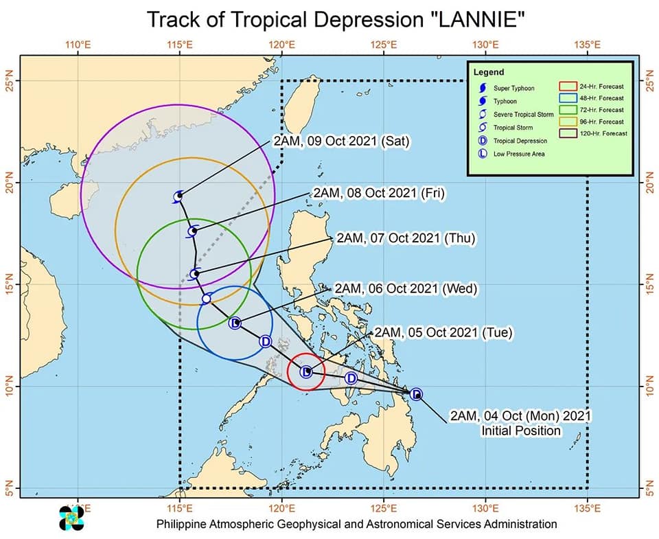
TRACK AND INTENSITY OUTLOOK
• On the forecast track, Tropical Depression “LANNIE” may make landfall in the vicinity of Siargao-Bucas Grande Islands in the next 6 hours. Afterwards, the tropical depression will move generally west northwestward and cross Dinagat Islands and Visayas archipelago before emerging over the Sulu Sea tomorrow early morning near or over the Cuyo archipelago. It will then turn northwestward and may pass near or over northern Palawan or Calamian Islands tomorrow morning or early afternoon before emerging over the West Philippine Sea tomorrow late afternoon or evening. Throughout the period of its traverse over the central Philippines, “LANNIE” is forecast to remain as a tropical depression, with a possibility of slight intensification once over the Sulu Sea
• After reaching the West Philippine Sea, “LANNIE” will continue moving northwestward until Thursday, when it is forecast turn more north northwestward and decelerate. From Wednesday until the end of the forecast period, “LANNIE” is forecast to intensify. It may reach tropical storm category by Wednesday afternoon and severe tropical storm category by the end of the forecast period.
Considering these developments, the public and disaster risk reduction and management offices concerned are advised to take all necessary measures to protect life and property. Persons living in areas identified to be highly or very highly susceptible to these hazards are advised to follow evacuation and other instructions from local officials. For heavy rainfall warnings, thunderstorm/rainfall advisories, and other severe weather information specific to your area, please monitor products issued by your local PAGASA Regional Services Division.The next tropical cyclone bulletin will be issued at 8:00 AM today.DOST-PAGASA
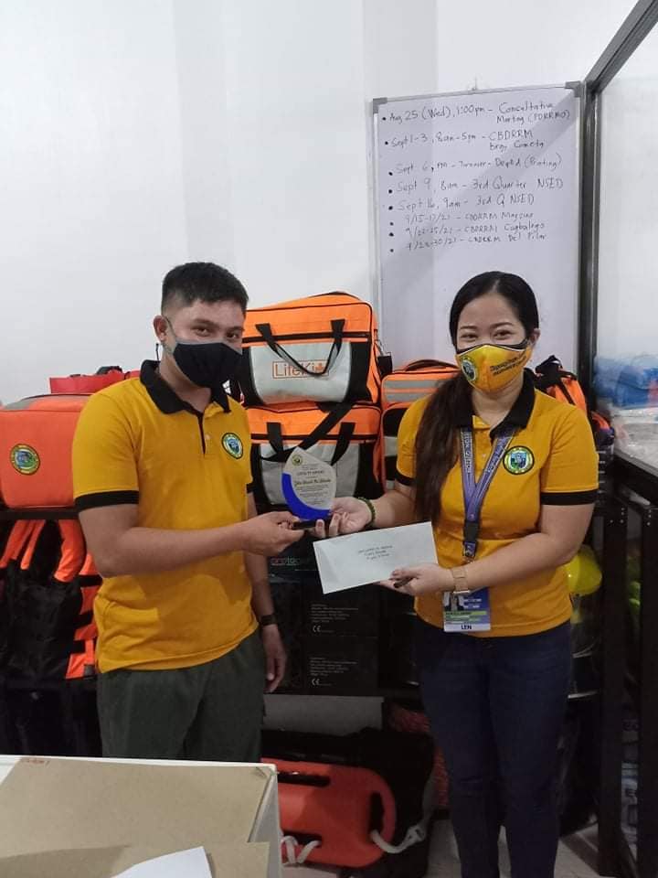
Patuloy ang pagbibigay ng transportation assistance ng aming tanggapan, sa direktiba ng ating Punong Bayan at tagapangulo ng MDRRMC Kgg. MA. CARIDAD P. CLACIO.
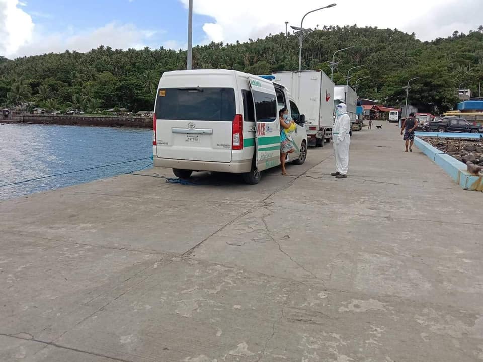
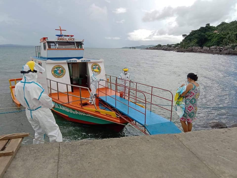
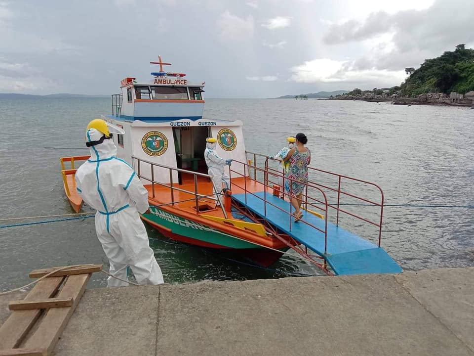
Sa direktiba ng ating Punong Bayan at tagapangulo ng MDRRMC Kgg. MA. CARIDAD P. CLACIO ay patuloy ang pagbibigay ng transportation assistance ng aming tanggapan sa ilang mga pasyenteng nangangailangang ilipat sa mas malaking ospital. Gayundin ang pag-uwi ng mga pasyenteng nagmula naman sa ospital patungo sa ating bayan.
Taos puso po naming ipinararating ang ating pasasalamat sa Quezon PDRRMO na aming katuwang sa pagtulong sa ating mga kababayan.
Hindi po biro ang magkasakit, kaya’t ugaliin po natin ang pagsunod sa Minimum Public Health Standards at makiisa po tayo sa ating ginagawang Vaccination laban sa COVID-19.
Maraming salamat po.
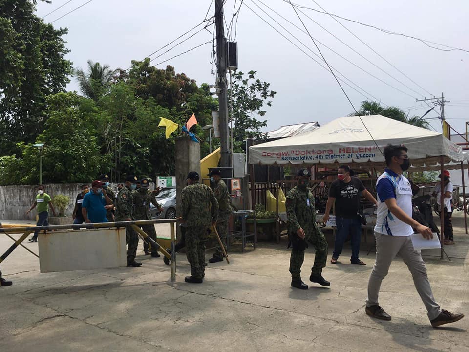
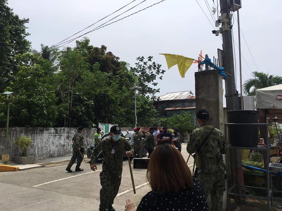
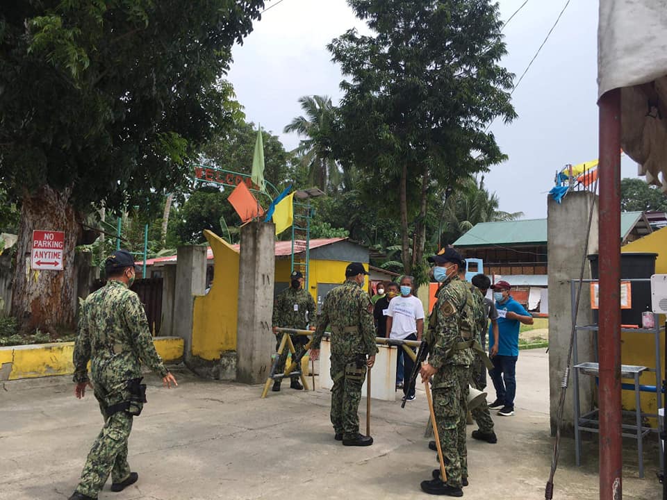
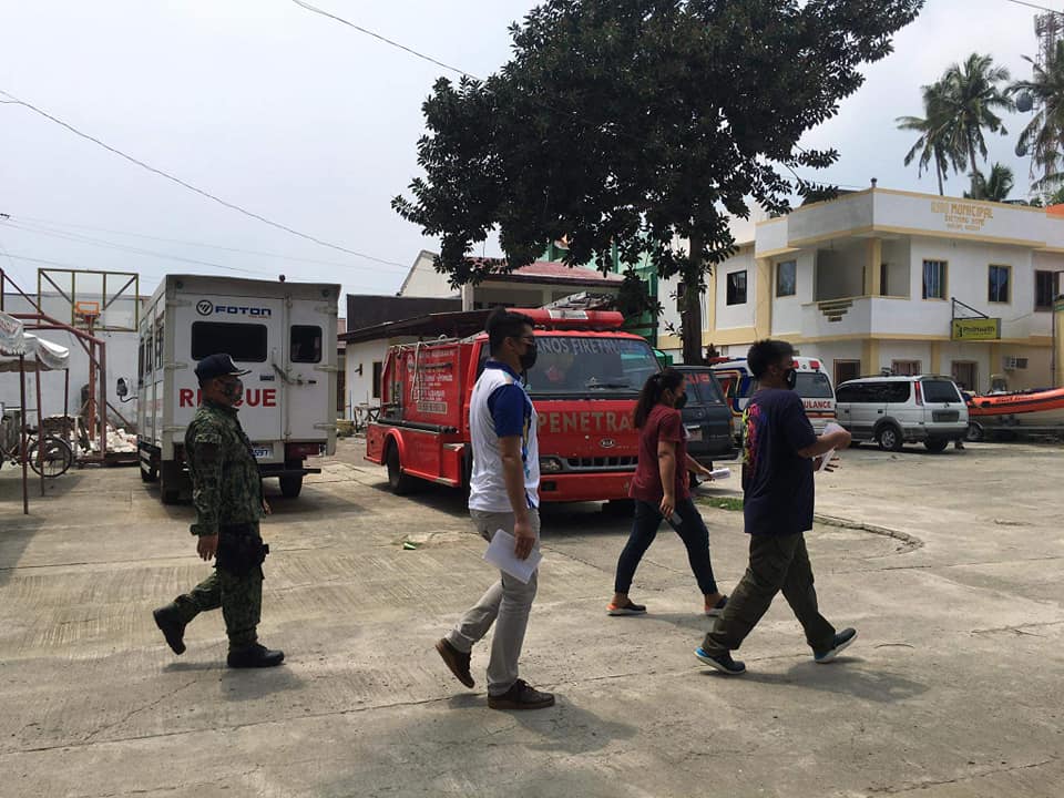
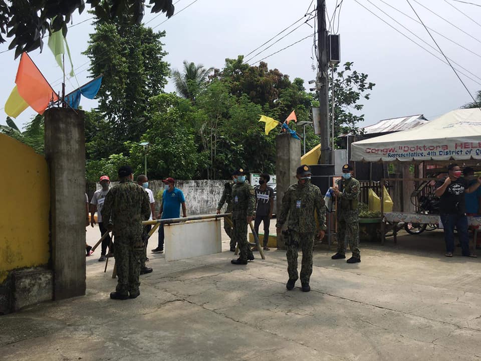
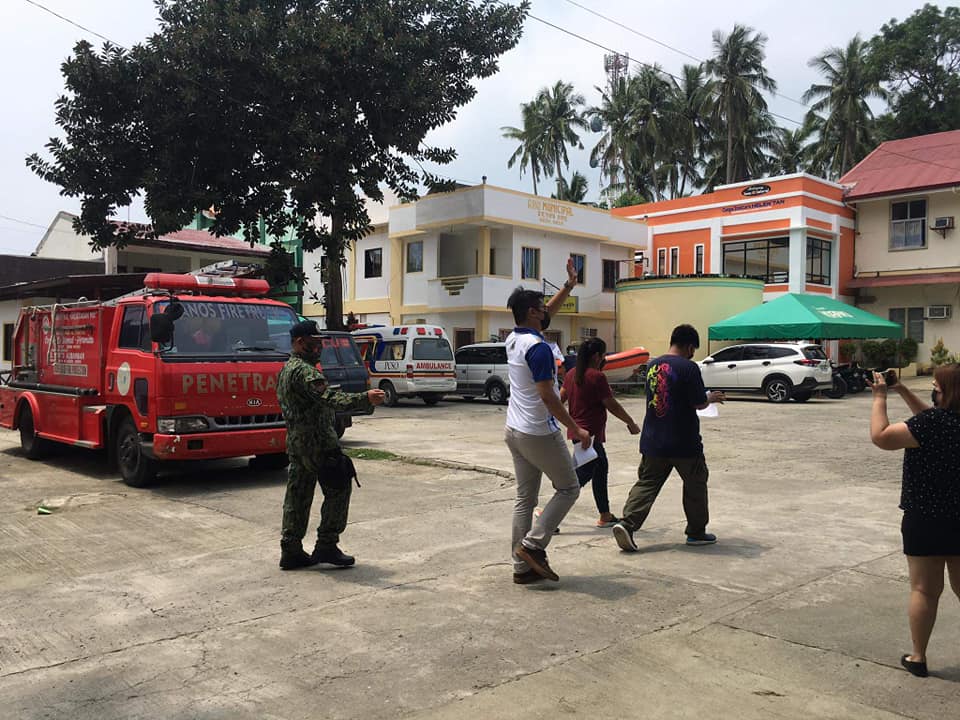
Simulation Exercise (SIMEX) was conducted by QMPS, MDRRMO and COMELEC in preparation for the filing of COC which starts tomorrow, October 1 until October 8, 2021.

September 30, 2021
12:00pm
Simulation Exercise (SIMEX) was conducted by Quezon Municipal Police Station (QMPS) headed by PLT Leo L. Lagrazon together with Quezon Municipal Disaster Risk Reduction and Management Office (MDRRMO) and Commision on Elections (COMELEC) in preparation for the filing of Certificate of Candidacy which starts tomorrow, October 1 until October 8, 2021.
MDDRMO is in-charged of health screening and ensuring the compliance of candidates, guests, personnel and employees to Minimum Public Health Standards (MPHS) during the filing of Certificate of Candidacy.
Disclaimer: Persons who appeared in the photos are the head and staff of MDRRM Office who acted for the conduct of SIMEX only and are not actual candidates.


CoViD-19 Updates in Quezon, Quezon as of September 22, 2021
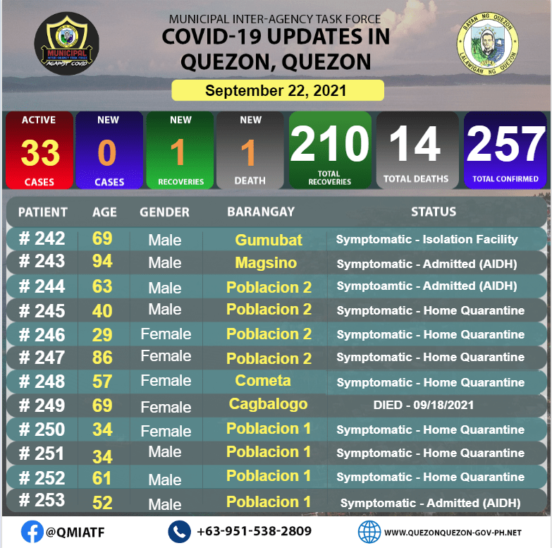
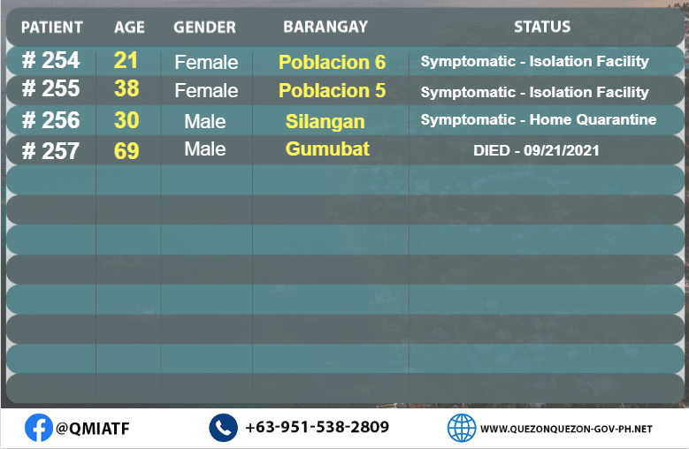
PABATID!!!
Mayroon po tayong kabuuan na 15 Recovered na kaso ng COVID-19 sa ating bayan . Labing-apat sa mga ito ay noong ika-19 at 20 ng Setyembre at isa ngayong araw.
Gayunpaman, Nadagdagan po ng 16 aktibong kaso ng COVID-19 sa ating Bayan. Labing-apat dito ay naitala noong ika- 18 hanggang ika-20 ng Setyembre at dalawa kahapon.
Ang nasabing 16 na bagong kaso ay may mga sintomas na naramdaman. Nakakalungkot din pong ibalita na sa 16 kasong napatala, 2 po ang namatay na ating kababayan.
Ngayon araw ay mayroon po tayong 33 kabuuang aktibong kaso ng COVID-19 dito sa Bayan ng Quezon, Quezon.
Ang ating IATF po ay nasa proseso ng karagdagang pagcocontact-tracing upang magabayan ang susunod na magiging hakbang.
Mahigpit pong pinapayuhan po ang lahat na mag-ingat at sumunod sa ating mga public health protocol.
Maraming salamat po.
Mayor’s Profile – Awards and Recognition
MAYOR’S PROFILE
NAME: MA. CARIDAD PAGKATIPUNAN CLACIO
SPOUSE: Former Mayor Crispin Sasot Clacio
FATHER: Engr. Crisogono Pagkatipunan (D)
MOTHER: Josefina Oreta Pagkatipunan
AGE: 55 years old
ORGANIZATION AFFILIATION
- League of the Municipalities of the Philippines –
Member (2016 – present)
- League of the Municipalities of the Philippines –
Member Quezon Chapter (2016 – present)
- KALIPI Municipal Federation – Honorary Chairperson
- 4K Municipal Federation – Honorary Chairperson


AWARDS AND ACHIEVEMENTS
- PLAQUE OF APPRECIATION, ADOPT-A SCHOOL PROGRAM given by the DepEd Quezon, December 2020
- PLAQUE OF APPRECIATIO, #DABESTKA! Given by DEpEd
CALABARZON, October 2020
- 2019 National Anti-Drug Abuse Council (ADAC) Performance
Award-Ideal given by Department of Interior and Local Government December 2019
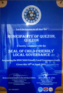
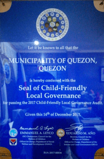
- SEAL OF CHILD-FRIENDLY LOCAL GOVERNANCE, given by DSWD & DILG, April 2019
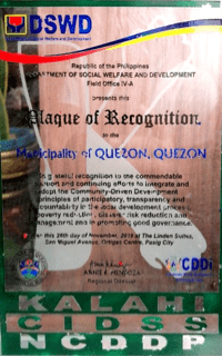
- PLAQUE OF RECOGNITION, Integrate and adopt KC-NCDDP, given by DSWD Field Office IV-A, November 2019
- PLAQUE OF APPRECIATION, Gawad Kaagapay, given by DepEd Division of Quezon, Adopt-a-School Program, December 2018
- PLAQUE OF RECOGNITION, as BFP’s Local Partner, for their advocacy of exemplary fire safety services given by the BFP Regional Office IV-A CALABARZON, August 2018
- PLAQUE OF APPRECIATION, given by Quezon, Quezon Public
Elementary Alumni Association, Inc., April 2018
- PLAQUE OF RECOGNITION, given by DOH RO IV- CALABARZON, June 2018
- GAWAD PARANGAL SA NUTRISYON, given by PNAO, July 2018
- SEAL OF CHILD-FRIENDLY LOCAL GOVERNANCE, given by DSWD & DILG, December 2017
Awards and Recognition
| Description | Date Given |
|---|---|
| Sertipiko ng Pagkilala, given by DSWD Region Field Office | December 2020 |
| 2019 National Anti-Drug Abuse Council (ADAC) Performance Award-Ideal, given by Department of Interior and Local Government | December 2019 |
| Plaque of Recognition, given by DSWD Region Field Office | November 2019 |
| Seal of Child-Friendly Local Governance, given by DSWD and DILG | April 2019 |
| Quezon Gawad Parangal sa Nutrisyon, given by PNAO and Provincial Nutrition Multi-Sectoral Council | July 2018 |
| Gintong Daloy Award- 1st Place, given by Department of Health | 2019 |
| Plaque of Recognition, given by Department of Health | June 2018 |
| Seal of Child-Friendly Local Governance, given by DSWD and DILG | December 2017 |
| Certificate of Recognition, given by DOLE-PESO-QueFPESO, Inc. | December 2017 |
| Seal of Child-Friendly Local Governance, given by DSWD and | December 2016 |
| Seal of Good Local Governance, given by Department of Interior and Local Government | November 2016 |
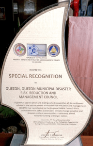
| Special Recognition, given by RDRRMC | November 2016 |